To form the cone, a set of imaginary circles are placed along the forecast track at the 12, 24, 36, 48, 72, 96, and 120 h positions, where the size of each circle is set so that it encloses 67% of the previous five years official forecast errors. The cone is then formed by smoothly connecting the area swept out by the set of circles.

There is also uncertainty in the NHC intensity forecasts. The Maximum 1-minute Wind Speed Probability Table provides intensity forecast and uncertainty information.
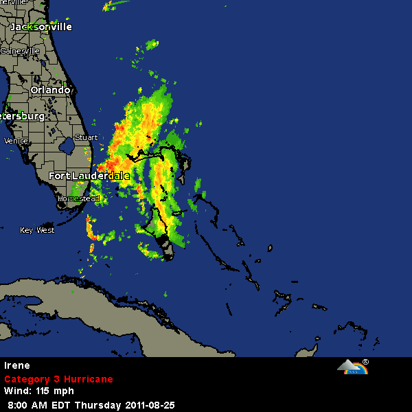
It is also important to realize that a tropical cyclone is not a point. Their effects can span many hundreds of miles from the center. The area experiencing hurricane force (one-minute average wind speeds of at least 74 mph) and tropical storm force (one-minute average wind speeds of 39-73 mph) winds can extend well beyond the white areas shown enclosing the most likely track area of the center. The distribution of hurricane and tropical storm force winds in this tropical cyclone can be seen in the Wind History graphic linked above.
Considering the combined forecast uncertainties in track, intensity, and size, the chances that any particular location will experience winds of 34 kt (tropical storm force), 50 kt, or 64 kt (hurricane force) from this tropical cyclone are presented in tabular form for selected locations and forecast positions. This information is also presented in graphical form for the 34 kt, 50 kt, and 64 kt thresholds.
0 comments:
Post a Comment